Cherith GeoSystems Master Logo
  • Home
  • About Us
  • Services
  • Projects
  • Experience
  • Blogs
  • Contact
Request a Survey
Surveying team on massive project site
Our Portfolio

Mapping of Distinction

Our portfolio reflects an unwavering commitment to precision, reliability, and excellence across high-stakes geospatial and structural engineering projects.
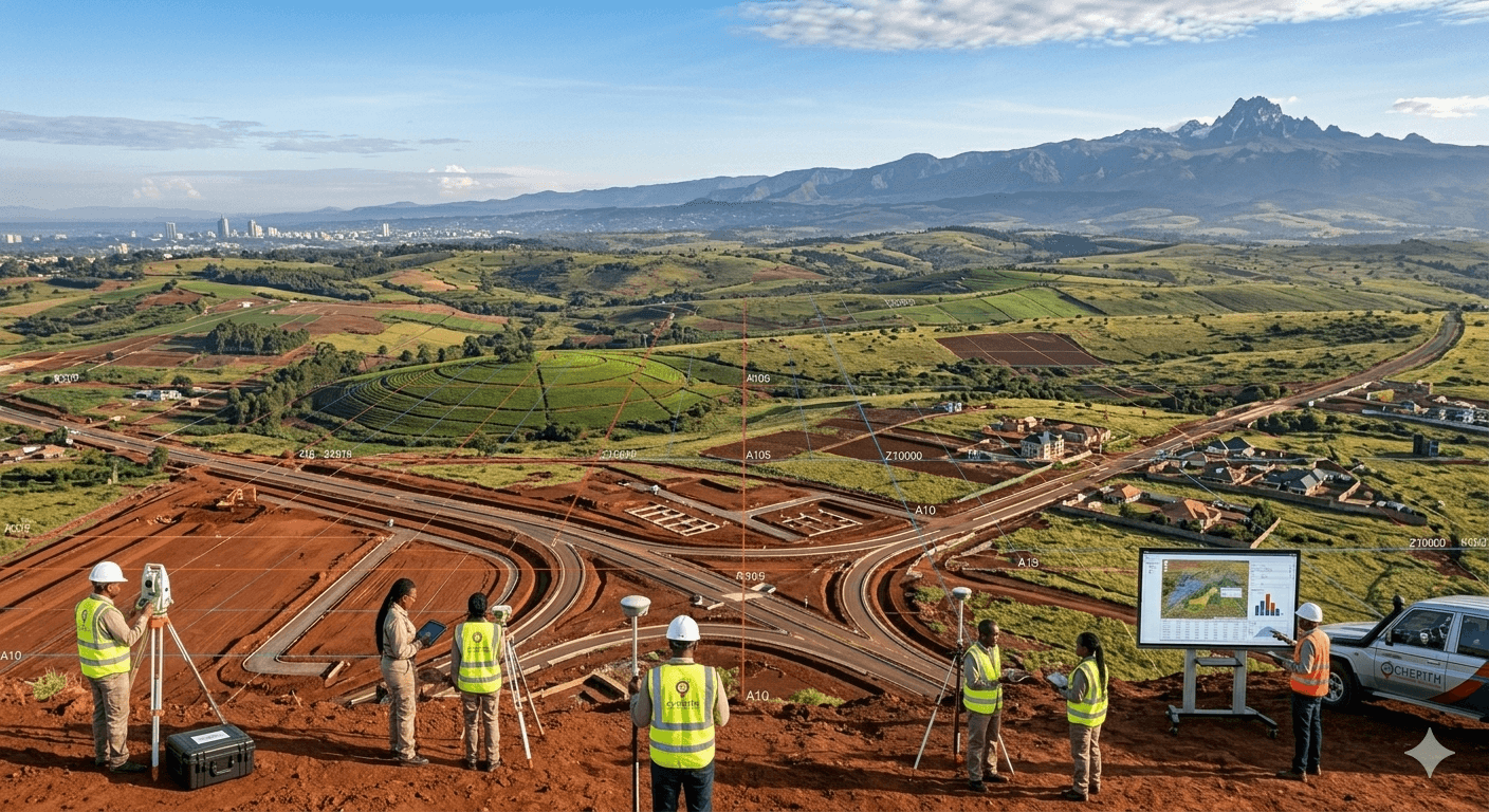
Project Portfolio

Explore our diverse footprint across East Africa, showcasing decades of precision in geospatial engineering.

JKIA Airport Topographical Survey
InfrastructureFlagship
Nairobi, Kenya2026

JKIA Airport Topographical Survey

Extensive and highly detailed mapping executing precision leveling and contouring to support major air-side infrastructure planning and rapid terminal development at Kenya's primary international aviation hub.

View Details
UNHCR GIS Regional Support Operations
GISFlagship
East & Central Africa2025

UNHCR GIS Regional Support Operations

Advanced Geographic Information Systems (GIS) deployed to optimize regional humanitarian operations. Provided meticulous data layering across East and Central Africa to support mass displaced population planning.

View Details
800-Acre Drone Mapping
Remote SensingFlagship
Maasai Mara2026

800-Acre Drone Mapping

Large-scale remote sensing leveraging RTK-enabled drone technology. Captured high-resolution true orthomosaics and digital elevation maps enabling strict land-use planning and ecological conservation mapping.

View Details
UN Gigiri Infrastructure Project
EngineeringFlagship
Nairobi, Kenya2025

UN Gigiri Infrastructure Project

High-stakes cadastral setting-out works and precise infrastructure leveling at the vast United Nations complex, ensuring structural alignment and strict compliance within an environmentally sensitive perimeter.

View Details
GPR Utility Mapping
GPR
Nairobi CBD2026

GPR Utility Mapping

Subsurface utility mapping using Ground Penetrating Radar to locate high-voltage cables and fiber optic lines prior to road expansion.

View Details
Broad Footprint

Experience Beyond
the Horizon

Our geospatial reach extends across the African continent, delivering precision engineering and GIS solutions to diverse nations and industries.

Explore Global Reach
400+

Cadastral Survey Assignments

Delivered rigorously validated boundary operations nationwide.

8+

Countries Reached

GIS deployments spanning Kenya, Rwanda, Uganda, Eritrea, Ethiopia, and beyond.

Multi-Sector

Industries Served

Supporting vast infrastructure & real estate development securely.

Ready to get started?

Need Accurate Survey Data You Can Trust?

Partner with Cherith GeoSystems for precision, reliability, and expert insights. Transform your physical land data into confident mapping intelligence today.

Get a QuoteContact Us
Cherith GeoSystems Master Logo

Transforming land and spatial data into accurate, actionable insights that power smarter decisions across Kenya and beyond.

LinkedInTwitter

Quick Links

  • Home
  • About Us
  • Services
  • Projects
  • Experience
  • Insights
  • Contact

Our Services

  • Land & Cadastral Surveys
  • Engineering & Topographical
  • GIS & Spatial Analysis
  • Remote Sensing & Drones
  • Underground Utility (GPR)
  • Web GIS Development

Contact Us

  • Office Location

    Olympic House, 1st Floor, Room 104
    P.O. Box 1968-00200
    Nairobi, Kenya

  • Phone

    0722 300 565 / 0721 448 913

  • Email

    info@cherith.co.ke
    gokusimba@gmail.com

© 2026Cherith Informatics & Mapping Ltd. All rights reserved.

Privacy PolicyTerms of Service